Course Tour
The Start
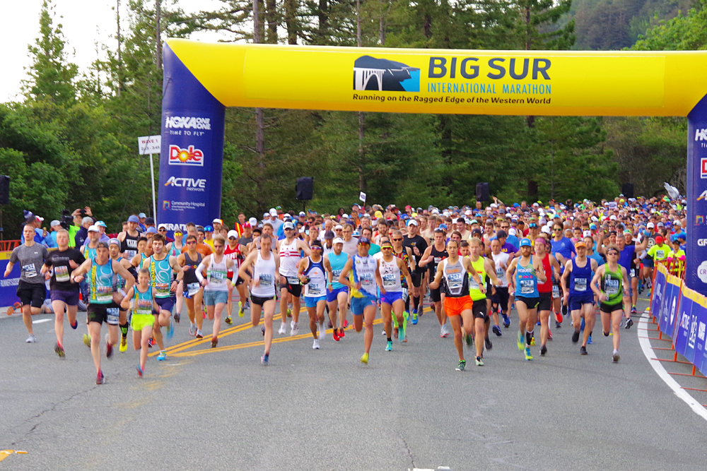
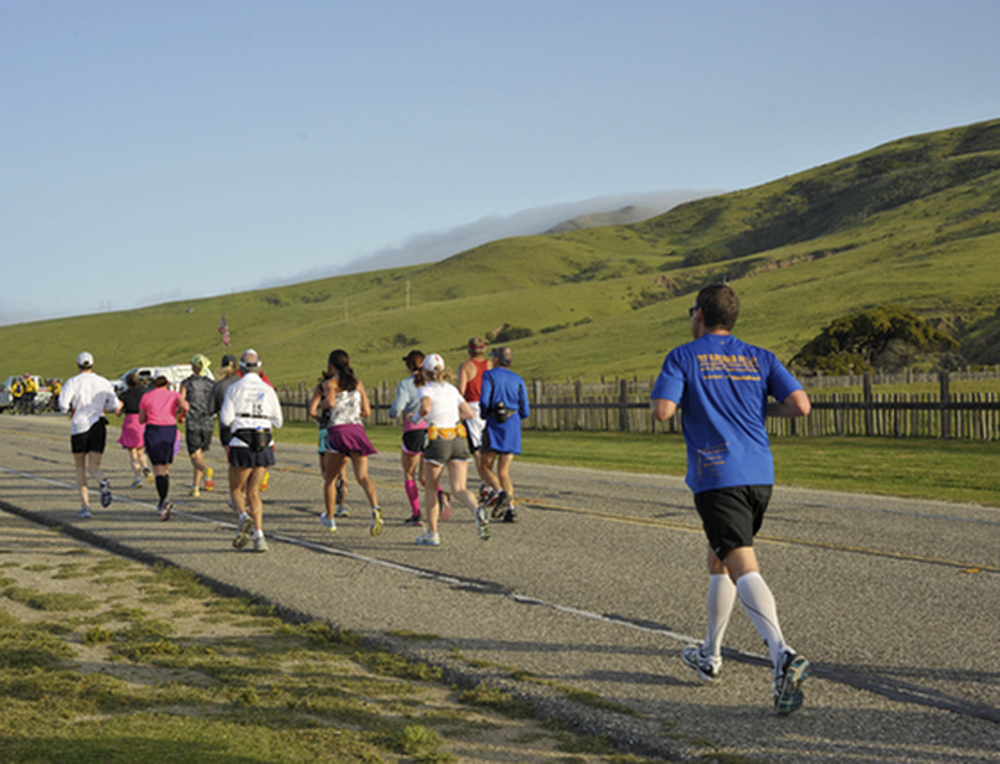
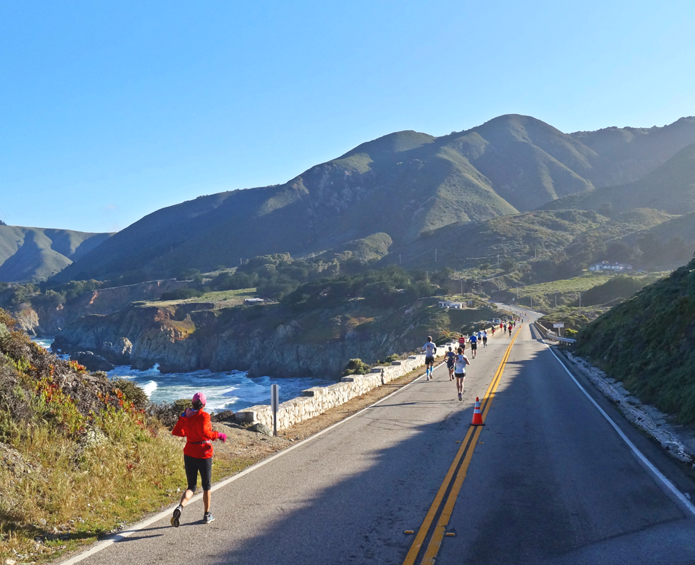
On the last Sunday each April the Big Sur International Marathon begins at 6:45 a.m. at the Pfeiffer Multi-Use Big Sur Station. Runners are bused to the start from various locations in Monterey and Carmel beginning shortly after 4:00 a.m. Big Sur mornings can be chilly (low 40's), so bring warm clothing and gloves for the duration of your wait. Come race morning this normally quiet stretch of highway will be transformed into a hub of frenzied activity with both runners and volunteers counting down the moments to the start. Following the National Anthem the race begins! The first mile is downhill and utilizes both lanes of Highway 1; it is wise to start out slowly.
Mile 1
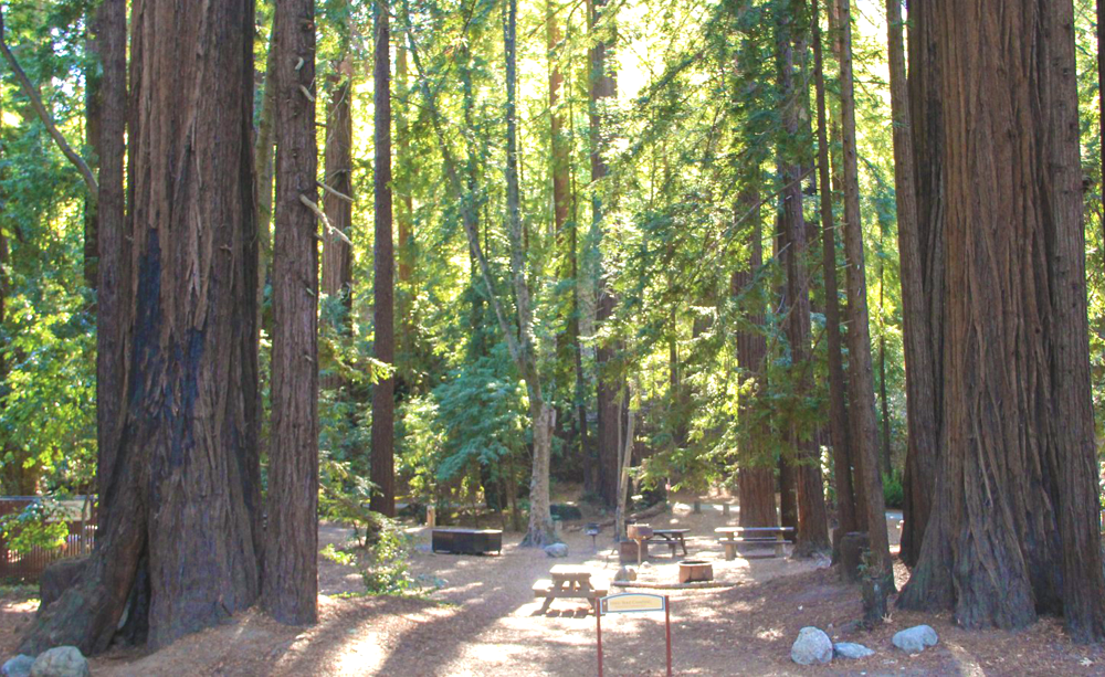
The first mile is fast and furious. Giant redwoods line both sides of the roadway and sparkles of light from the rising sun dance in the canopy of branches overhead. The air is crisp and chilly. Both lanes are still open and there is a lot of talking and laughter between runners as they settle into the miles ahead. Runners pass by Pfeiffer Big Sur State Park, a wonderful site to camp if you are staying in Big Sur.
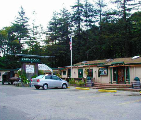
Mile 2
The downhill slowly levels out and occasional signs of civilization appear. Runners pass by Fernwood, a motel and watering hole popular with the locals. You will receive spectator support at various Big Sur stores and restaurants where the residents appear in small groups to cheer on the runners. The redwoods begin to thin and the day grows ever brighter. The talk between runners gives way to the soothing music of gurgling streams next to the road.
Mile 3
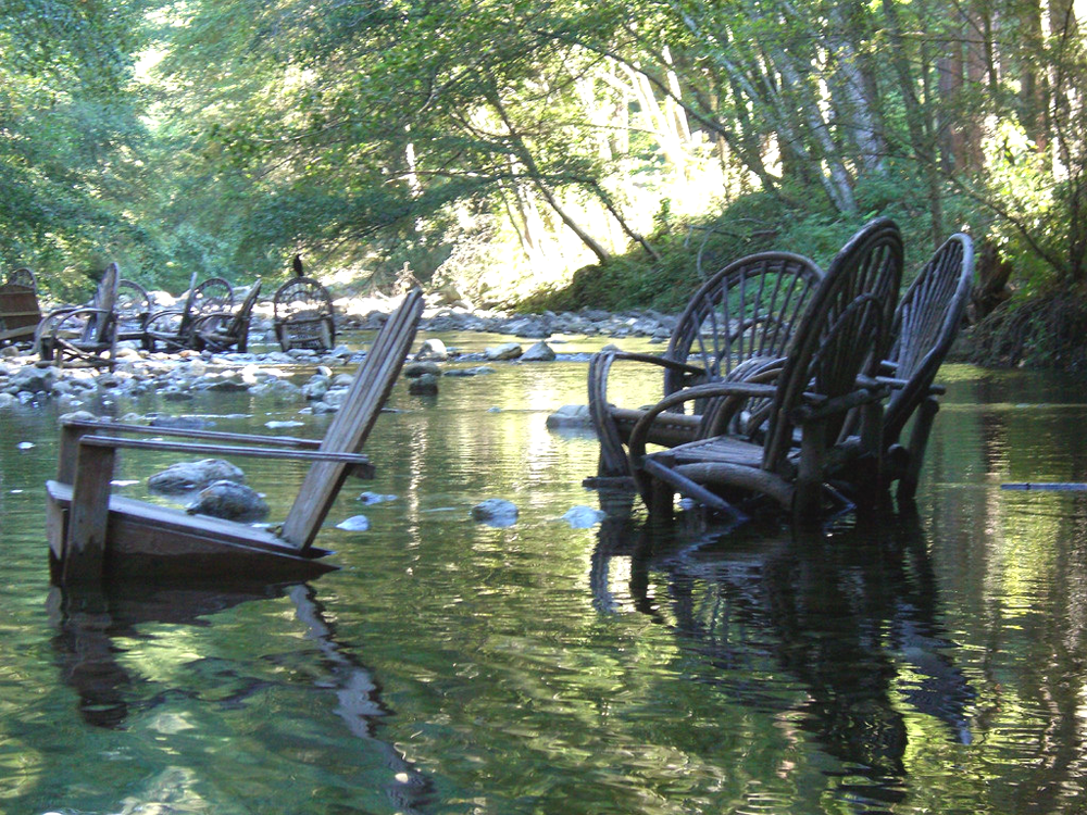
Wildlife is abundant in Big Sur, but most creatures retreat from the activity along Highway 1 on this particular Sunday. Wild turkey, deer, bobcats, raccoons, fox and even mountain lions populate the mountains of Big Sur. Civilization is evident here as well. Runners pass by the Big Sur Library, one of the Marathon's grant recipients. Near the end of mile three runners pass by the popular River Inn, a Big Sur landmark. The River Inn offers both food and lodging, and a great place for tired marathoners to soak their legs in the river following the race. Consider staying at the Inn the night prior to the Marathon. It will allow a few extra hours of needed sleep.
Mile 4
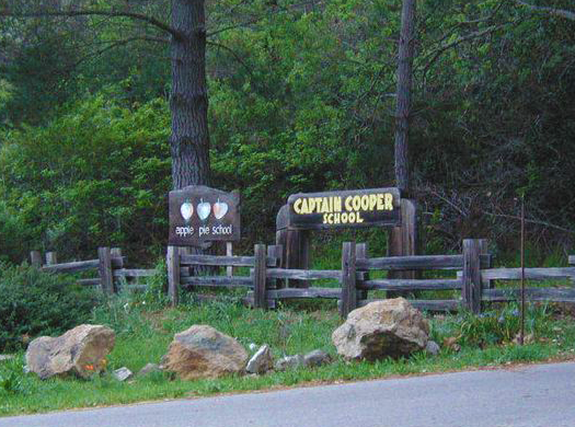
Mile 4 marks the end of the downhill sections that dominate the early part of the Marathon. The road flattens out and oak and pine trees replace the tall redwoods. One can almost smell the ocean from here. Wildflowers and calla lilies grow along side the road and runners pass by two of Big Sur's schools, the Captain Cooper School and the Apple Pie School. Both are Big Sur grant recipients and many of the children attending these schools participate in the By-the-Bay 3K run.
Mile 5
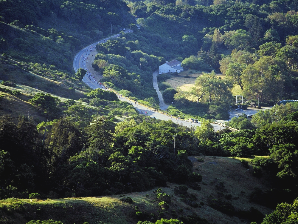
At mile 5 the tone of the Marathon changes. Runners have left the serenity of Big Sur's redwoods and have settled into a comfortable pace. The coastal mountain range suddenly comes into view as the sun emerges from behind the tall crests. Runners pass by Andrew Molera State Park, the starting point of the 21-Miler, as well as an ideal place to camp and hike. The first leg relay runners reach their baton hand off at mile five. On the right side of the road is the southern entrance to the Old Coast Road, a 10 1/2 mile stretch of rough road that parallels Highway One and offers stunning views of the coast.
Mile 6
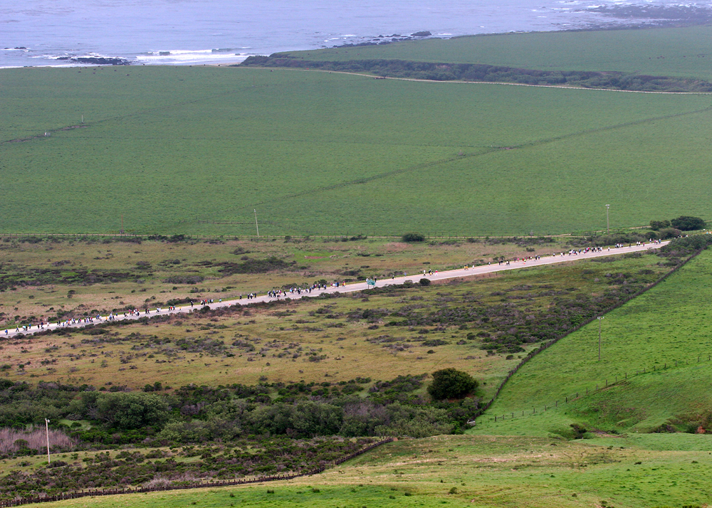
By Mile 6 runners have left the protective redwood forest of Big Sur and the scenery makes a sudden dramatic change. The views have become pastoral, with towering hills on the right and green meadows to the left. On the right it is not uncommon to see horses frolicking amidst the wildflowers. Look left and cows will be grazing on the grass. These equine and bovine spectators are quieter than their human counterparts but may offer a "moo" or whinny to passing runners. It is also at mile 6 that runners get an inkling of what weather conditions they may be facing in the miles ahead. It may be overcast with high clouds or a low, thick fog may blanket the road. On a sunny day runners are more likely to encounter fierce headwinds that will buffet them in the miles ahead.
Mile 7
Mile 7 marks the start of a long gradual rise, a subtle hint of what lies ahead. This hill shouldn't prove too taxing unless, of course, the wind is blowing. Every few years, the wind blows from the south, giving runners a gentle push up this hill. The ocean is visible to the left and the sun has now risen over the coastal mountains to the right. By mid summer the fields of grass will be dry and brown, but on the last Sunday in April they are green and lush; the hills are awash with vibrant, colorful wildflowers.
Mile 8
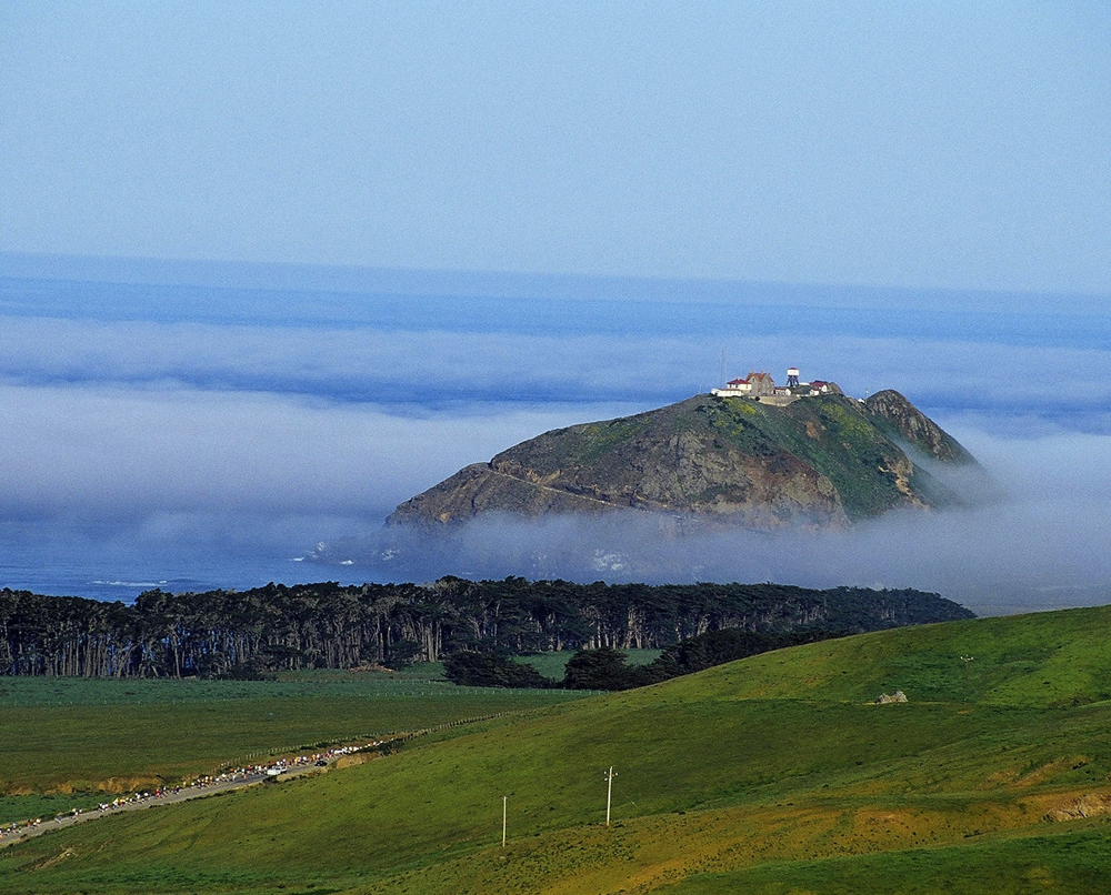
Just past the Mile 8 marker, the gentle hill of mile 7 suddenly turns steep. This is the first significant hill on the course. Rather than looking ahead and bemoaning your fate, look to the left. While fog may obscure the ocean on a cloudy day, on a clear day you will be treated to a great view of the Point Sur Lighthouse. Built in 1889, the lighthouse was home to three lighthouse keepers and their families. It was a lonely isolated life as the road from Monterey to Big Sur was not an easy journey in those days. One wonders if they ever considered ... running it? Tours of the lighthouse are available, an informative and interesting way to spend an afternoon either before or after the Marathon.
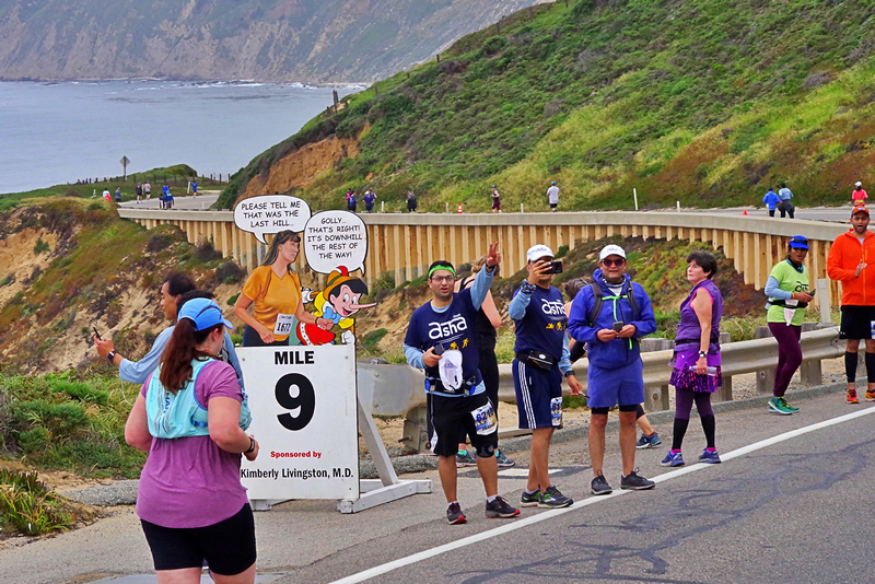
Mile 9
Just before the mile 9 marker runners crest the hill and round a bend in the road, beginning the nearly mile long descent to the Little Sur River Bridge. If you look across the horseshoe shaped bend in the road you will see runners ahead beginning the long journey up Hurricane Point. It is best at this point NOT to do that. Enjoy the downhill section, stretch out your legs; let yourself recover from the long uphill.
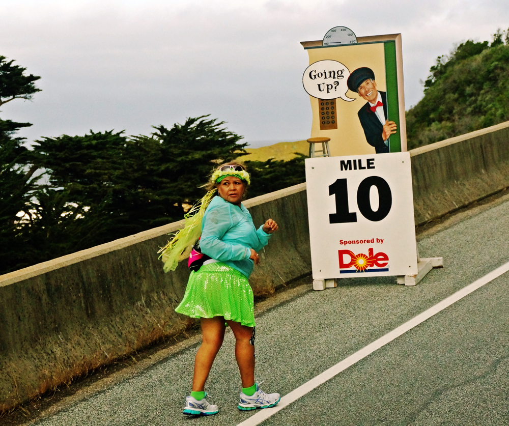
Mile 10
Mile 10 marks the beginning of the two mile ascent of the notorious Hurricane Point. You will feel refreshed from having just partaken of water and Gatorade at the aid station; you will have received thunderous applause from several hundred relay runners still on the road. Even the wind is quiet now, the hill itself providing a windbreak for the next two miles.
Mile 11
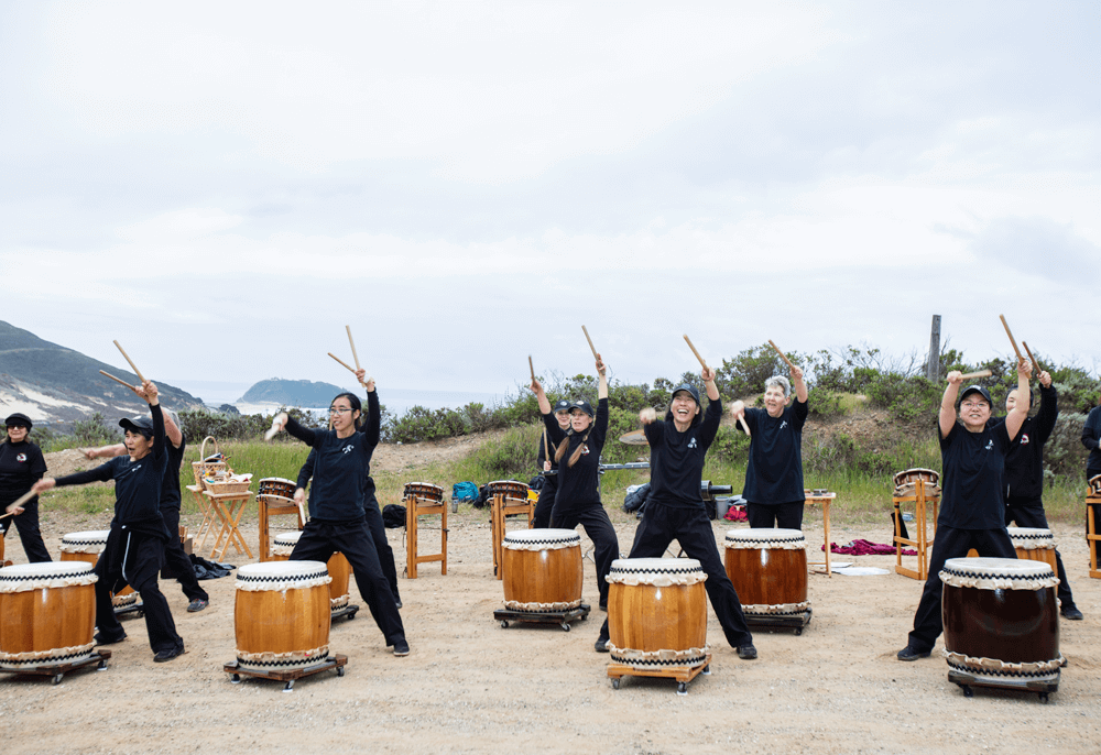
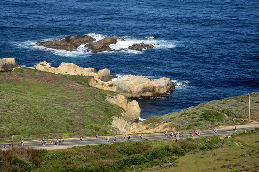
Deep breaths and determination will get you through mile 11. This is the new location for the Taiko Drummers, half-way up the climb. The road curves and winds, a narrow band of asphalt sandwiched between steep rocky cliffs on the right and a sheer drop to the pounding surf and rocks on the left. Clusters of wild flowers thriving on the rocky soil brighten the view and it is good to stop occasionally and take it all in. As you continue to climb higher, stop and look back at where you've been. The full magnificence of the south coast is revealed, as the mountains appear to fall into the sea.
Mile 12
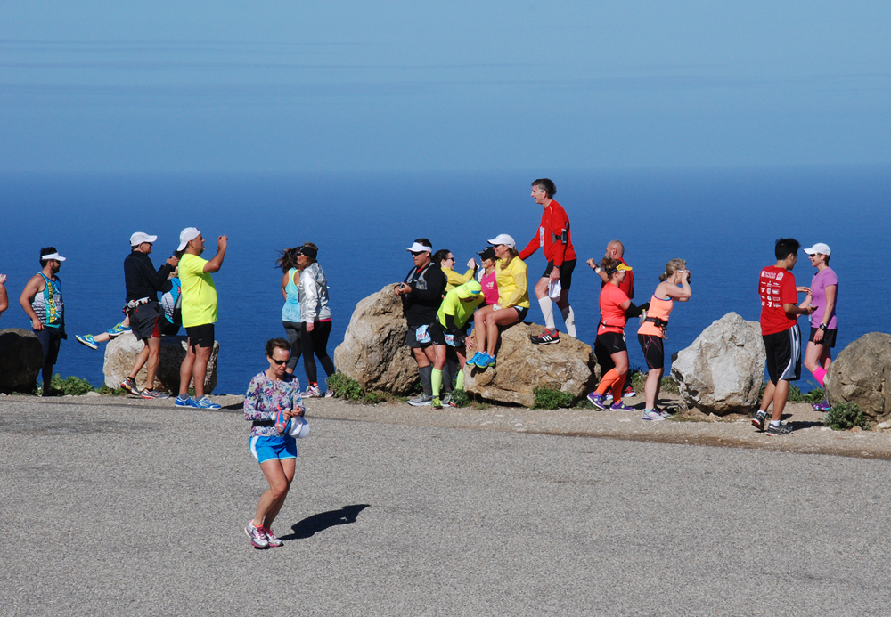
Mile 12 is actually less steep than mile 11, although only your watch will confirm this. The ascent by now seems endless, each curve offering the hint of the summit at last; but, alas, more curves and false summits are in store. An aid station offers sustenance to get you through this last stretch and when you finally think you can't climb another step, the summit comes into view at last. During a blustery year the wind at the Point can almost knock you off your feet and push you backwards. If conditions are calm, stop here and look back at what you've accomplished. Then look ahead and you will see Bixby Bridge and hear the subtle notes of the Yamaha grand piano being played by young virtuoso Michael Martinez.
After the race be sure to purchase a Hurricane Point Survivor shirt. You've earned it.
Mile 13
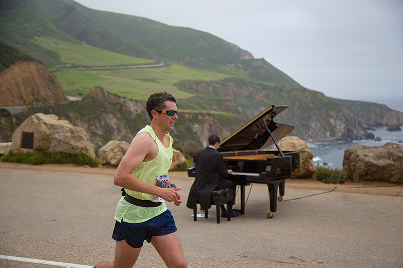
Mile 13 is one of the best miles on the course, especially if you like downhill. You are giddy from having survived Hurricane Point and now are rewarded with a long winding downhill mile. Be careful, though, and don't pound your quads too hard; the race is only half over and many more hills lie ahead. At the bottom of this hill is the world-renowned Bixby Bridge, the halfway point of the Marathon.
As you descend Hurricane Point you will hear the hauntingly beautiful music of Michael Martinez playing a Yamaha Piano. Smile as you cross the bridge, MarathonFoto will take your picture here, with the bridge under your feet and Hurricane Point in the background.
Mile 14
Mile 14 continues downhill. Hey, two uphill miles should be followed by two down! It is a bit like doing Hurricane Point in reverse. Runners cross the Rocky Creek Bridge just prior to the mile 14 marker, a smaller version of Bixby. The view ahead promises at least 12 more miles of spectacular scenery.
Mile 15
Mile 15 is a good reality check. You've survived Hurricane Point, you've experienced the euphoria of crossing Bixby Bridge, you have had two miles to recover and suddenly you are heading uphill again. Mile 15 is good time to plan the rest of your race, which will be a series of ups and downs.
Mile 16
Mile 16 is the start of the 11-Miler at the Grimes Ranch on the east side of Highway 1. Just past that is an aid station, just past the entrance to Palo Colorado Canyon. If you are driving the Coast Highway during your stay here, a side trip down this road is a must. Giant redwoods, rustic houses, creeks with huge ferns growing on the banks all convey a sense of serenity. Looking back from here you can still see the summit of Hurricane Point.
Mile 17
By mile 17 the reality of wind and hills has sunk in for most, but the beauty of the wildflowers and the turbulent sea provides inspiration to keep moving forward. Runners cross over Garrapata Bridge, which spans a popular beach for many locals. It is a splendid place to come the next day after the Marathon for a picnic, a leisurely walk in the sand and the chance to dip aching legs into the cold Pacific Ocean.
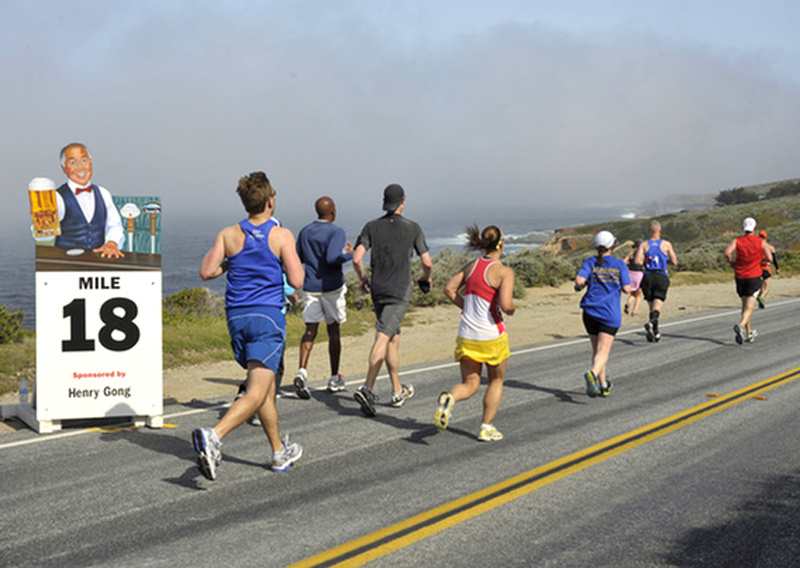
Mile 18
By mile 18 runners are thinking that the hills are flattening out just a bit. Runners cross over another small bridge, the Granite Canyon Bridge
Mile 19
While it may seem as if a new hill looms ahead following each curve in the road, there are some flat stretches on mile 19. This is the point in the race where it is time to get tough.
Mile 20
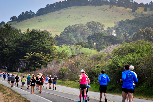
Mile 20 arrives before you know it! You'll pass by Soberanes Point, another great hiking opportunity if your weekend time allows. At the mile 20 marker runners are greeted by our own interpretation of "The Wall." Don't be intimidated by this towering cliff of dirt... you've a mere 10K to go!
Mile 21
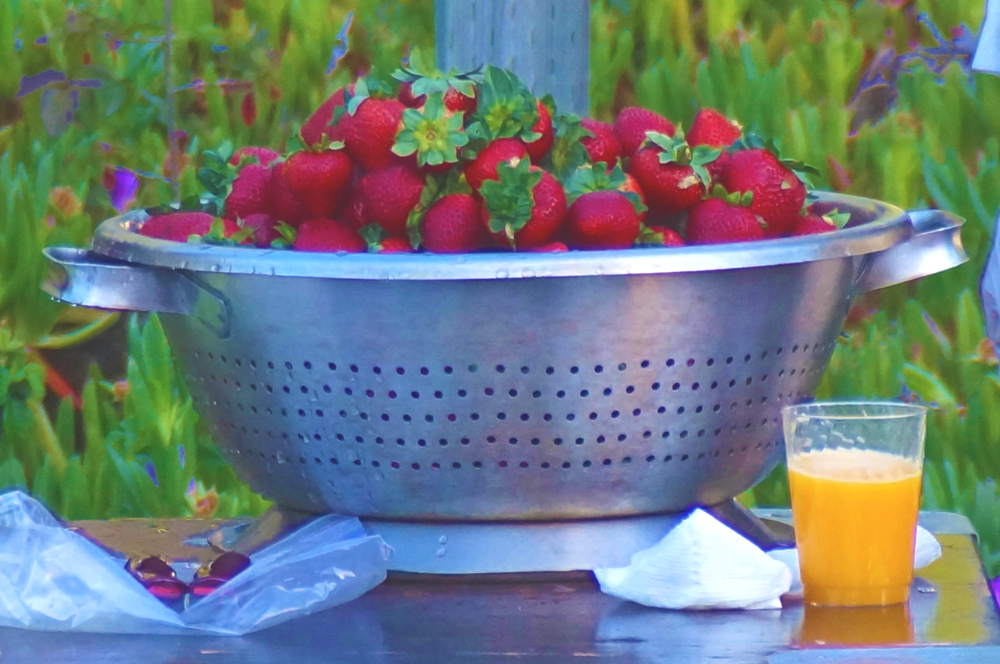
Mile 21 brings the first hints of civilization since leaving Big Sur. Houses begin to appear and soon there will be people as well. Locals come in groups and cheer on the runners and walkers, offering unofficial aid in the form of water and perhaps strawberries.
Mile 22
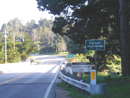
When runners cross Malpaso Bridge they officially enter the Carmel Highlands. Just the mention of the Highlands strikes fear into the hearts of Big Sur vets. It is a series of short steep hills made all the more brutal by the sharp cant of the road which wreaks havoc on tired quads and tender ankles.
The scenery proves a giant distraction as do the increasing number of people who will encourage you to just hang in there for a few more short miles.
Mile 23
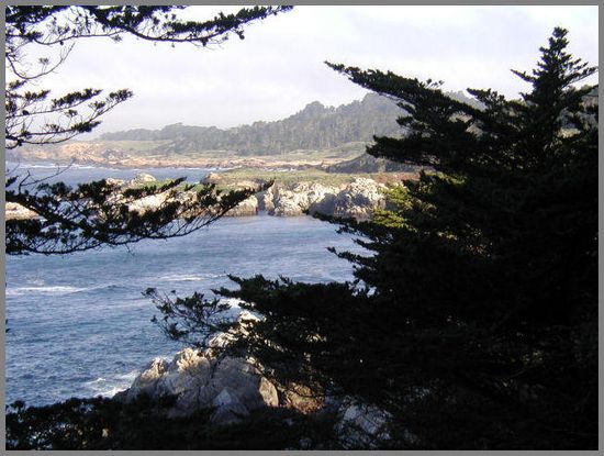
The mile 23 marker lies just past the entrance to the Highlands Inn, a wonderful place to stay or just enjoy a superb meal. If you look to your left you can catch glimpses of the heavy surf breaking against huge boulders. The native cypress trees seem to grow right out of the rocks.
Mile 24
Each year the Highlands Chevron Station at mile 24 offers a party of sorts to entertain exhausted runners. There will be live music, raucous crowds cheering and clapping, and a bevy of small children handing out fresh strawberries.
Best of all, the road flattens out and there is no more wind. A garden of rocks on the right side of the road offers a scenic diversion.
Mile 25
At the start of mile 25, runners pass by the entrance to Point Lobos State Natural Reserve, a "must visit" if you are spending some time on the Monterey Peninsula. The 12K does a loop through Pt. Lobos, making it a popular addition to Big Sur's lineup of weekend races.
At Monastery Beach runners will be treated to an exhibition of dancing by the by the Sambahamians. Looking right, runners get a peek of the Carmelite Monastery nestled amongst the trees.
Mile 26
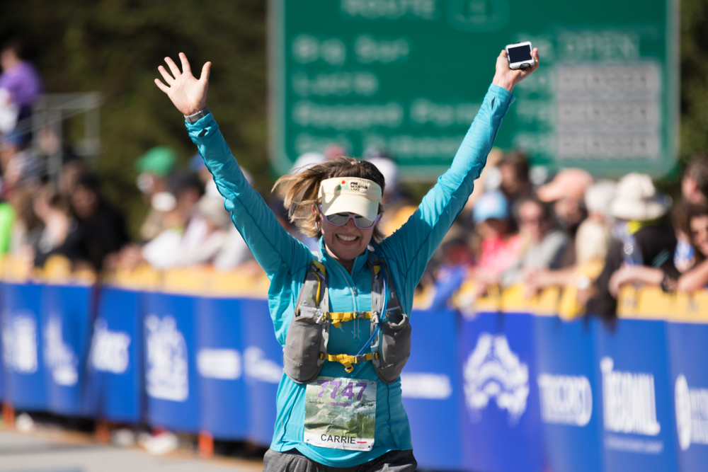
At last...that final mile that summons up a runner's last reserves. Aptly named "D-Minor Hill at D-Major Time," a final hill rises 90 feet from sea level but is only about a quarter mile in length. Runners have a chance for water at the final aid station on the course as they start up the hill. As you crest the hill you might catch a glimpse of the finish banner in the distance. The remainder of the course is a gentle down hill, and the mile 26 marker is at the far end of the Carmel River Bridge. Spectators will be out in full force now, and the noise is deafening. As you cross the Finish Line, be sure to raise your hands high and savor what you have accomplished.